Climbing Mount Ararat 2024 seasons expedition! 
Booking for Mount Ararat climbing started!
Category: Mount Ararat Information
History, Geographic and climb information of Mount Ararat
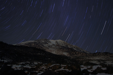
Mount Ararat Overview
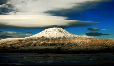
Mount Ararat (also Mount Masis after the Armenian name Մասիս, Turkish Ağrı Dağı) is a snow-capped, dormant volcanic cone in Turkey. It has two peaks, Greater Ararat (the tallest peak in Turkey with an elevation of 5,137 m (16,854 ft)) and Lesser Ararat (with an elevation of 3,896 m (12,782 ft)).
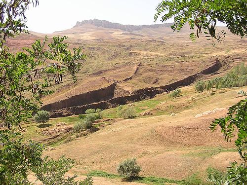
Mount Ararat is located in Eastern Turkey's Eastern Anatolia Region on the borders of Iran, Armenia (formerly U.S.S.R.), and Nakchivan. Mount Ararat’s summit is located some 16 km (10 mi) west of the Iranian and 32 km (20 mi) south of the Armenian border. The Nakhchivan exclave of Azerbaijan is also in close proximity to the mountain. The Ararat plain runs along its northwest to western side. This volcanic mountain rises 5,165 meters or 16,945 feet high, far above the plains those are at 2,000-3,000 feet high, and are the highest location in the ancient territory of Urartu, a region that covered tens of thousands of square miles with hundreds of mountains.
Mount Ararat in Judeo-Christian tradition is associated with the "Mountains of Ararat" where according to the book of Genesis, Noah's ark came to rest. It also plays a significant role in Armenian nationalism and irredentism.
Names and etymology of Mount Ararat
Mount Ararat:
Ararat is the newer Armenian name of Urartu from the Hebrew Torah written by Moses (c. 1400 BC), which only included the consonants "rrt". However, the translators of the Bible replaced the "rrt" with the later name, "Ararat" or "Armenia." The Assyrian kings wrote about battles against the Urartian tribes from the thirteenth century BC (c. 1286 BC) until the sixth century BC when the Medes destroyed Urartu. The name Urartu then vanished from history (until archaeologists re-discovered it in the 1800s) and was replaced by Ararat and Armenia in the vicinity as well as in English Bible translations, maps, etc. As history went on in the first and second millennia AD, the mountain became known as Ararat and the region as Armenia.
According to the medieval Armenian historian Moses of Khoren in his History of Armenia, the plain of Ayrarat (directly north of the mountain) got its name after King Ara the Handsome (the great grandson of Amasya). Here the Assyrian Queen Semiramis is said to have lingered for a few days after the death of Ara. According to Thomson, the mountain is now called Ararat (Armenian: Արարատ) by confusion with Ayrarat, the name of the province. Influenced by Biblical tradition, Ararat is also used in many other languages. The association of the mountain with the story of Noah is however comparatively recent in Armenian culture, according to Murat (1900) not pre-dating the 11th century. The historical name of the peak in Armenian is Masis or (in the plural, referring to both peaks) Masik.
Masis:
Ağrı Dağı:
Ağrı is also a province in the Eastern Anatolian Region of Turkey, which named from mountain at 1949. During the Ottoman Empire era the Ağrı village was originally called Karakilise (black church).
Çiyayê Agirî (Fiery Mountain), Çiyayê Alavhat and Grîdax (Kurdish): This entire tree name referred a volcanic characteristic of Mount Ararat. Name Ararat also used by Kurdish.
Persian: Koh-i-Nuh, Mountain of Noah Also influenced by the flood story, this time via the Islamic view of Noah.
Geology of Mount Ararat:
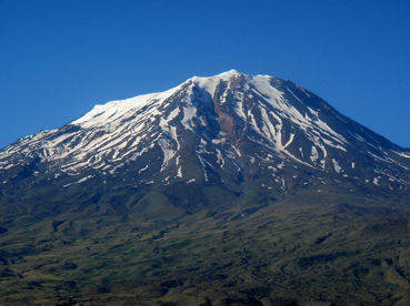
Ararat is a stratovolcano, formed of lava flows and pyroclastic ejecta, with no volcanic crater. Above the height of 4,200 m (13,780 ft), the mountain mostly consists of igneous rocks covered by an ice cap.
A smaller 3,896 m (12,782 ft) cone, Little Ararat, rises from the same base, southeast of the main peak. The lava plateau stretches out between the two pinnacles. The bases of these two mountains are approximately 1,000 km2 (386 sq mi).
The formation of Ararat is hard to retrieve geologically, but the type of volcanism and the position of the volcano raise the idea that seduction relation volcanism occurred when the Tethys Ocean closed during the Neogene, as recently occurred along the borders of the Eurasian, African and Arabian plates from Cabo de Gata to the Caucasus.
Ararat has only a few native trees growing on it in Ahora village, shrubs around Korhan, and several small forests on Little Ararat. Views differ as to whether Ararat formed much of its size after the flood (post-flood) or partially during the flood with post-flood uplift and lava flows. Some geologists like Clifford Burdick have found pillow lava (lava spewed into water, ice, or snow) up to the 14,000-foot level where the 17-square mile ice cap typically begins. However, since pillow lava may be formed with ice or snow water, it is not a convincing argument for a flood-time mountain creation. Geologists believe that cylindrical and very steep mountains like Little Ararat show that it is most probably a post-flood mountain. There are also claims of fossils and sedimentary layers on Greater Ararat but these claims have not been backed up with concrete evidence as of this date although there are evidence of fossils in the Ararat valley limestones from both the Geologist Abich and the explorers. The Mount Ararat region along with the Araxes river valley constitutes a possible beginning location for the archaeology of the Early Transcaucasia culture with its distinctive red-black burnished ware. There are a number of Heliolithic and Early Bronze Age archaeological sites around Mount Ararat in Turkey, Armenia, and Nakchivan.
Mount Ararat's Elevation:
From 14,000 feet to 17,000 feet, much of the lava is covered by an ice cap, which is about 17 square miles in size and is up to 350 feet deep. The coordinates that cover the ice cap area on Mount Ararat are N 39 degrees 41' to N 39 degrees 44', E 44 degrees 15' 30" to E 44 degrees 19' 30". The area of this rectangle is about 31.6 square kilometers.
Mount Ararat's Activity:
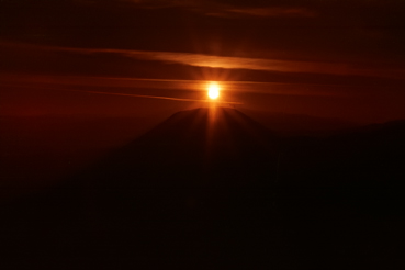
Not known when the last eruption of Ararat occurred there are no historic or recent observations of large-scale activity recorded. The last eruption will have occurred somewhere in the last 10000 years. It seems that Ararat was active in the 3rd millennium BC; under the pyroclastic flows, artifacts from the early Bronze Age and remains of human bodies have been found.
The large earthquake shook Ararat in July 1840, the effects of which were largest in the neighborhood of the Ahora Gorge (a northeast trending chasm that drops 1,825 meters (5,988 ft) from the top of the mountain). An unstable part of the northern slope collapsed and a chapel, a monastery, and a village covered by rubble. According to some sources, Ararat erupted then as well, albeit under the ground water level.
The large earthquake shook Ararat in July 1840, the effects of which were largest in the neighborhood of the Ahora Gorge (a northeast trending chasm that drops 1,825 meters (5,988 ft) from the top of the mountain). An unstable part of the northern slope collapsed and a chapel, a monastery, and a village covered by rubble. According to some sources, Ararat erupted then as well, albeit under the ground water level.
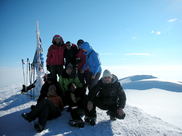
Climbing Mount Ararat
First recorded climb Mount Ararat:
Later Mount Ararat ascents:
Years later, in 1845, the German mineralogist Otto Wilhelm Hermann von Abich climbed Ararat with Abovian. Abovian's third and last ascent to Ararat was with the Englishman Henry Danby Seymour in 1846. In 1856, a group of five explorers led by Major Robert Stuart climbed Mt. Ararat.
Mount Ararat Climbing Routes:
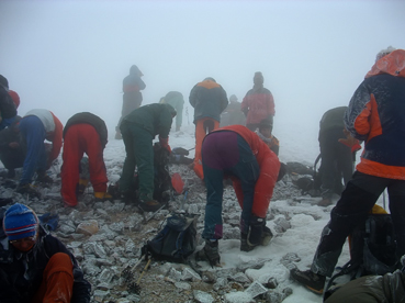
Mount Ararat Climbing permits and guides:
The Turkish government requires a climbing permit and use of a certified Turkish guide. Arrangements can take two months to complete. However, getting Mount Ararat climb permit with licensed Turkish travel agency makes this time more short.
Earliest Historical Reference to Noah's Ark being on Mount Ararat
How it is that Philostorgius even knows that the Ark landed on the Armenian Mount Ararat in ca. 425 AD if supposedly (as Bailey et al. contend) no one came up with that idea until medieval times and no one ever made such identification until then?
Amidon states the following in the introduction about Philostorgius: "The learned and fervently Eunomian layman Philostorgius, born in Cappadocia around 368, heartily detested such historiography as may be imagined [this reference is to the Council of Nicaea's Nicene Creed supporters like Rufinus who translated and extended/massaged Eusebius of Caesarea writings into Latin to show support for Nicene Christianity]. The remnants of his writing show a lively intellectual curiosity encouraged by his sectarian creed, whose God is not the hidden deity of Gnosticism but one whose very substance can be known by human reason directed aright. He obviously drank deeply from the libraries, museums, and archives of Constantinople, his Dissimilarian spectacles bringing into focus a picture of the century preceding that was very unlike the one painted by Rufinus, with whom his own narrative, when he came to write it, was indeed in frequent argument... It appeared sometime between 425 and 433, in twelve books bound in two volumes, its proper period the years from 320 to 425... Philostorgius in fact groups into one 'homoousian' party all those Christians who opposed Eunomianism (in the same way as those of Nicene sympathies like to call 'Arian' anyone who rejected the term 'consubstantial' as used in the Creed of Nicaea)... Such is the central dram of our author's history: the enduring contest between the true monotheistic faith of God's people and the pagan forces arrayed against it. Gnosticism is always the silent partner in the debates between Nicene and Eunomian Christians, the real foe against whom Aetius fought the battle that nearly led to his death. And there is some evidence that this view comes from Eunomius himself. This being the tenor of Philostorgius's history, it is not surprising that the government that championed the Nicene faith would seek to suppress it, seeing that it had previously ordered the burning of the works of Eunomius, one of the great heroes of his tale... He followed Herodotus's lead in historiography, embroidering his narrative with learned excursions into geography and natural history and in general cultivating style that would recommend him to his readers. The style was no empty show. His immersion in the scholarly resources offered by Constantinople has preserved for us, even in the abridgement of its original work, traditions that are otherwise unknown or that add perspective to matters related elsewhere."
Philostorgius stated the following about Noah's Ark and Mount Ararat in Book 3 as epitomized by Photius who according to Amidon "is usually a careful, if hostile, epitomizer, and his editorial glosses can usually be detected":
"The Persian Gulf, which is formed by the ocean as it enters there, is huge and is encircled by many nations. The Tigris is one fo the enormous rivers that empty their streams into it at its mouth. The Tigris seems to have its source in the east, south of the Caspian Sea in Corduena, and it flows past Syria, but when it arrives in the region of Susa, the Euphrates joins its current to it, and so it boils onward, swollen now to a great size. Hence they say it is called "Tigris" after the animal. But before it descends to the sea, it divides into two great rivers, and then it empties into the Persian Gulf from these two mouths at its end, which are divided from each other. It thus cuts off a considerable area of ground in between, making of it an island that is both of the river and of the sea; it is inhabited by a people called the Mesenes. As for the Euphrates River, it appears to take its rise in Armenia, where Mount Ararat is. The mountain is still called by that name by the Armenians. It is where, according to scripture, the ark came to rest, and they say that considerable remnants of its wood and nails are still preserved there. From there the Euphrates starts as a small stream at first, growing ever larger as it advances and sharing its name with the many rivers that empty into it. It makes its way through Greater and Lesser Armenian and then proceeds on, dividing first the Syria that is properly called Euphratensis and then also the rest of Syria. Having passed through this region, and the remaining part [of Syria], and having broken up the lands through which it passes into a series of convolutions of every sort with its crooked course, it draws near to Arabia. There its way takes it in a circle opposite the Red Sea as it loops around a wide region, after which it turns toward the Caecias wind, midway between north and east. It then heads toward the Tigris River, although it cannot join its whole self to it, but wasting part of itself on the way, it empties the remained of itself into the Tigris quite near Susa, this remainder being a mighty stream quite capable of carrying ships. There it also abandons its name and flows with the Tigris down to the Persian Gulf. The land between these two rivers, the Tigris and Euphrates, is called Mesopotamia."
Since the upper reaches of this volcanic mountain are covered with broken lava rock everywhere and are currently extremely difficult to ascend or descend, its present state makes it a poor location for Noah's Ark to land and for all the animals to easily descend. Some have theorized if the mountain was lower after the flood and then was uplifted later on with more volcanic activity around the parasitic cones similar to Little Ararat. Yet, Mount Ararat has the bulk of the purported eyewitnesses of the boat-like structure since 1850. These "alleged" eyewitnesses are one reason why the search may continue on the mountain.
Given the extensive research which has taken place on Mount Ararat, it seems fair to say that if Noah's Ark ever survived into modern times and is somewhere on Ararat, there are few new places remaining on the mountain to search unless it is buried under the ice cap or lava. There have been many expeditions, accounts, alleged sightings, anomalies, and claims of discovery involving Mount Ararat. What is lacking is any scientific evidence or photo that shows that Noah's Ark survived until today. However, one should also consider the possibility that Noah's Ark landed on Mount Ararat and was subsequently destroyed, which is the possibility alluded to in the article Even If Noah’s Ark Is Not Proven, Noah’s Ark Still Could Have Landed On Mount Ararat.
Given all the ground and aerial expeditions (and one with sophisticated mapping capabilities), one should surmise that if the remains of Noah's Ark are indeed on Mount Ararat, they are not in plain view; if the boat is there, it must be buried. There have been 2 attempts that used sub-surface Radar (Ground Penetrating Radar - GPR) technology on Mount Ararat to look under the ice. The 1988 Willis expedition and the 1989 Aaron/Garbe/Corbin expedition used GPR. The 1988 Willis expedition successfully surveyed the eastern summit plateau and the saddle area between the two peaks, concluding there were no Ark remains under the ice. The 1989 expedition was not as successful as the preceding year, where a less-capable GPR system was used in temperate (melting) ice cap conditions on the western plateau of Mount Ararat. However, they were able to determine the ice depth on the western plateau and scale the size of the Ark. As the next generation of commercial RADAR Satellites become available, the GPR will not be needed and it should be clear if any anomalies are underneath the ice cap.
If the remains of Noah's Ark were in moving ice on Mount Ararat (there is only one legitimate glacier, the Black Glacier, though there are other moving ice flows like the so-called Parrot Glacier), the Ark would have been ground to bits. ArcImaging contends that until the entire mountain has been adequately "sub-surface" surveyed using the latest RADAR technology, some people such as the alleged eyewitnesses contended that the Ararat ice cap contains the remains of Noah's Ark since about 90% of the supposed eyewitnesses claim that the boat was sticking out of the ice even though the explorers over the past 50 years did not see the same boat-like structure.